Geological data platform for everyone
Accelerate your analysis with US geological data, global satellite mineral analysis, and advanced tools in a single place.
Preloaded Data from US Public Sources
Automated Satellite Mineral Analysis
Filter, Aggregate and Visualize in Seconds
Preloaded Data from US Public Sources
Automate and Global Satellite Mineral Analysis
Filter, Aggregate and Visualize in Seconds
Accelerate your analysis
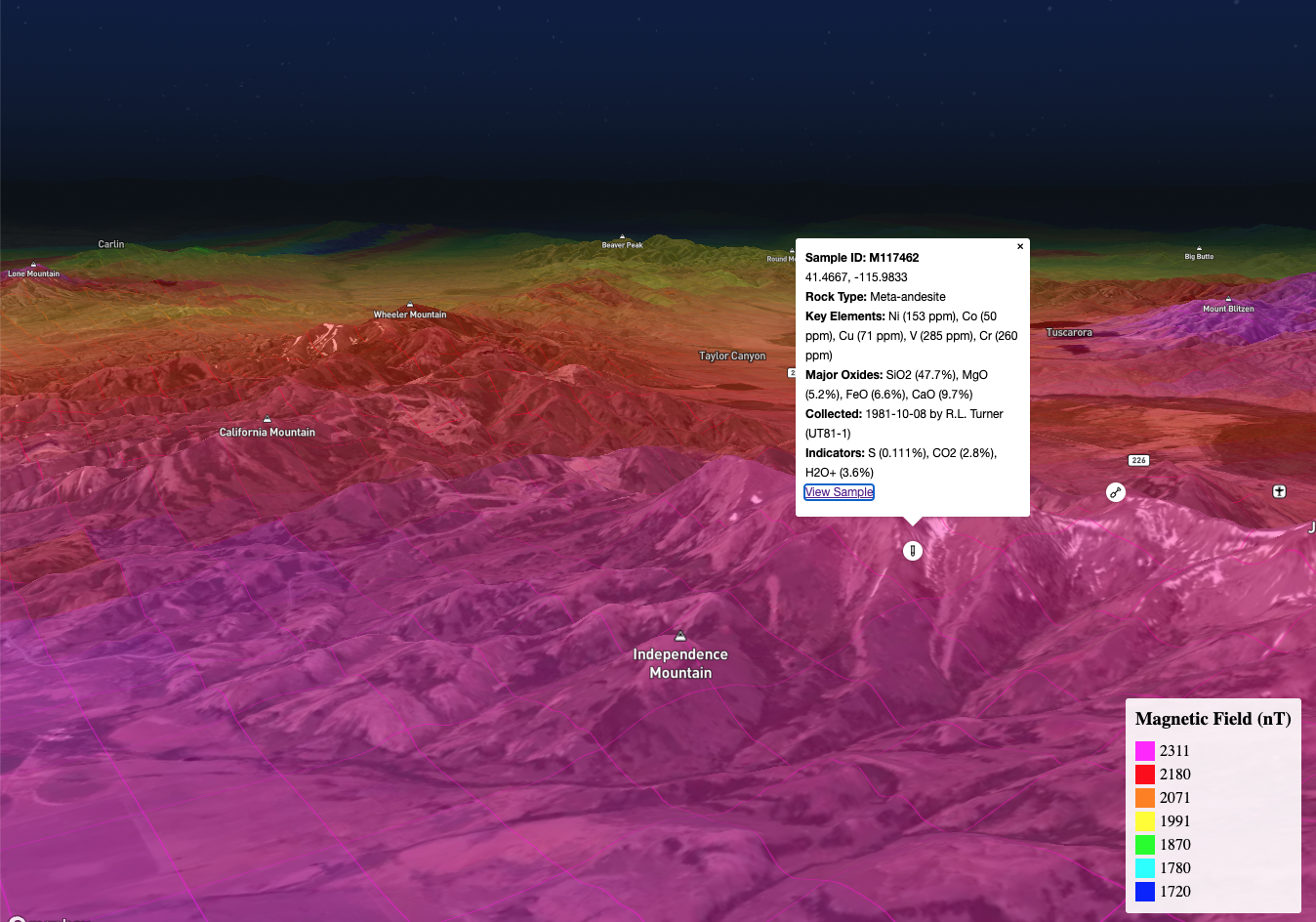
We've consolidated and standardized data from the major US public sources so you can focus on analysis not data collection. Data is preloaded from: USGS MRDS Data, NURE-HSSR Data, USGS Earth MRI, USMIN Mineral Deposit Database, USGS NGMDB, USGS National Chemical Database, Oregon MILO Database, Nevada Bureau of Mines and Geology (NBMG) Database, and more.
Get Started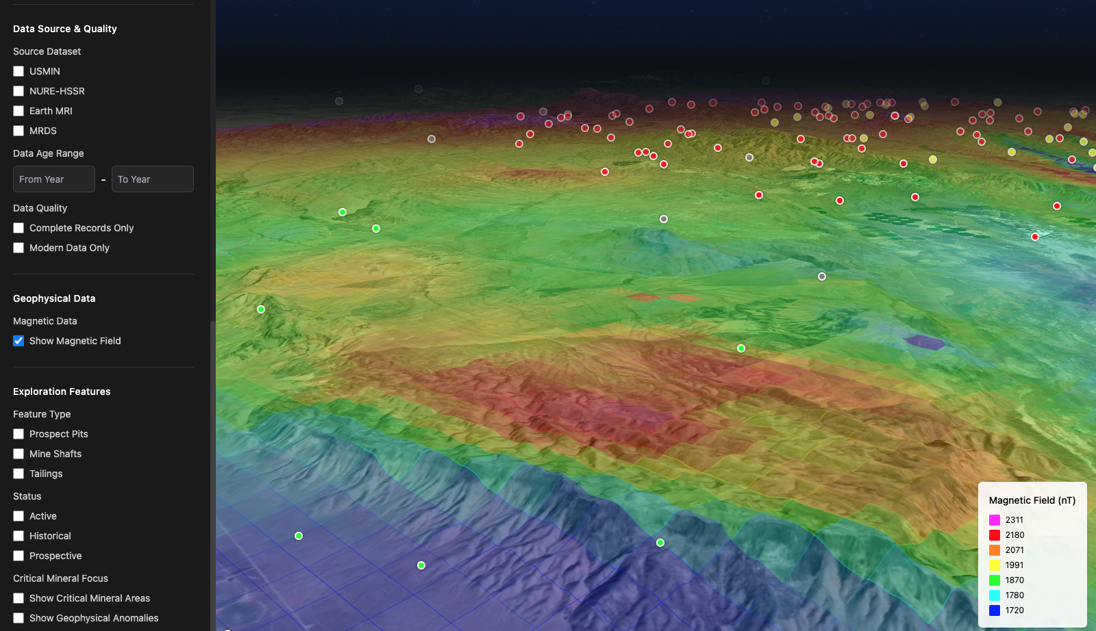
USGS Aeromagnetic Data plotted alongside MRDS, USMIN, NURE-HSSR Sample Databases and National Geochemical Database.
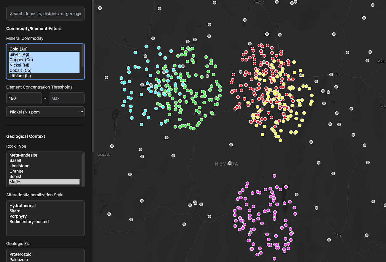
Apply advanced filtering and visualization of sample attributes in seconds. Reduce the noise so you can focus on the signal.
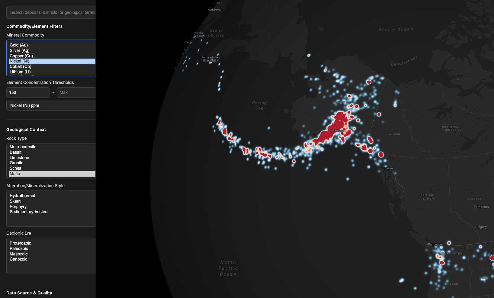
Filter, search, aggregate and visualize in seconds
Easily filter data across all data sources using common attributes identifying the areas of interest quickly.
Get StartedVisualize data across all sources on one map
Effortlessly create heat maps of filtered data in a couple of clicks.
Get Started Heat map visualization showing data density across regions.
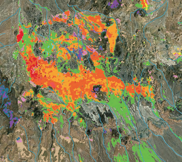
Automated Satellite Mineral Analysis: Uncover Hidden Deposits with Precision
Unlock the power of satellite technology with our Automated Satellite Mineral Analysis feature, designed for geologists and mineral exploration professionals seeking efficient, data-driven insights. This tool integrates cloud-free, continuously updated imagery from Landsat, Sentinel-2, ASTER, and PRISMA. We automate detection and mapping of mineral signatures with precision—identification of iron oxides, clays (e.g., kaolinite, illite), carbonates, silicates (e.g., quartz), and alteration zones linked to hydrothermal systems, even in remote areas. From regional-scale exploration to detailed deposit targeting, this feature automates the analysis process, saving time while revealing critical mineral associations and geological structures previously hidden from traditional methods.
Get Started Satellite imagery analysis showing mineral signatures and alteration zones.
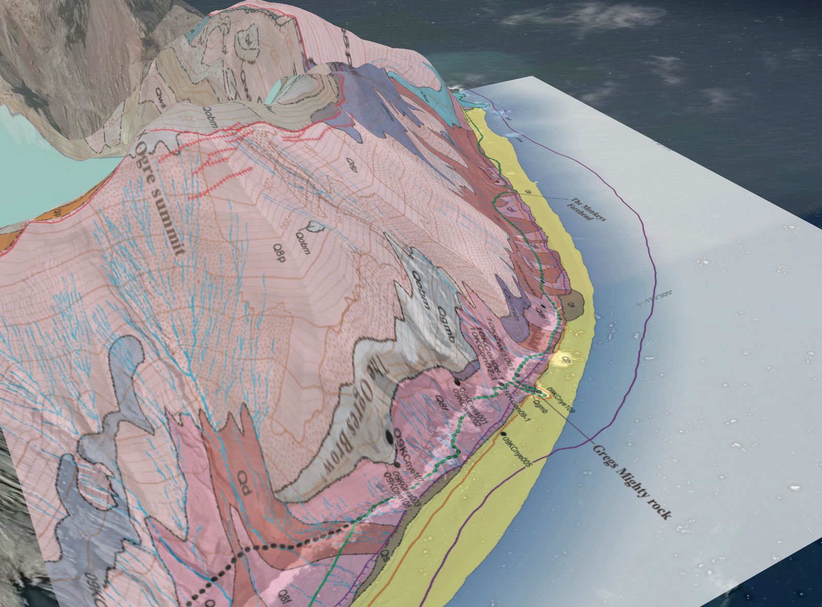
Digitized NGMDB with Advanced Filtering
Access the full power of the National Geologic Map Database with GeoForge's digitized maps, featuring standardized legends and intuitive filtering for rock types, formations, and ages. Customize layer colors to suit your needs, seamlessly integrating historical geological data with modern satellite imagery and mineral databases for faster, more precise exploration and research.
Get StartedExport your data in multiple formats
Download your filtered data in CSV, Excel, KML, GeoJSON, and Shapefile formats for seamless integration with your existing workflows.
Get StartedReady to get started?
Create an account or talk to one of our experts.